Town of Gibsons, British Columbia
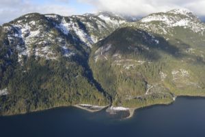
The community that start it all. Gibsons is blessed with many natural assets, which form a fundamental part of the Town’s infrastructure. The Gibsons Aquifer, for example, provides water storage and filtration, while delivering drinking water so pure it meets health standards without any chemical treatment. Creeks and woodlands help manage the rainwater. And the foreshore area of the beaches acts as a natural seawall. Click here for more information on the work they’ve completed to date on natural asset management.
Cohort 1 Project Communities
These communities have completed their pilot projects:
City of Nanaimo, British Columbia
A key objective for the City of Nanaimo related to understanding and maximizing municipal services from the Buttertubs Marsh Conservation Area, a 55 HA/133 acre reclaimed wetland/floodplain in the center of the City. Prior to the MNAI pilot, City efforts related to the Marsh focused primarily on maintaining open water habitat, inventorying and restoring natural biodiversity, and removing invasive species. No costing estimates for the value of stormwater management or other services had been conducted.
The City of Nanaimo wanted to answer a number of management questions through the project, including:
- How resilient is the Marsh to future storm events; how well can it manage in different storm scenarios?
- What is the value of the services provided from the Marsh; if these services were degraded, what costs would need to be incurred elsewhere by the City? Conversely, if they were enhanced, would there be savings to the City?
- What is the value of the wetland’s water retention properties? Does it offset future capital expenditures and / or justify any land acquisition?
- What is the value of the Marsh in terms of assuring downstream water quality?
To the extent possible with the model and data availability, these questions were addressed in the context of other natural and engineered components of the sub-watershed.

District of West Vancouver, British Columbia
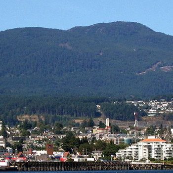
The District contains 13 watersheds, each with numerous tributaries. Some tributaries are in a natural state, and others are channeled through underground pipes and culverts. The ecological benefits of returning streams to above ground channels or “daylighting” and returning them to a more natural state are well-documented. They can include improvements to water quality, flood mitigation and habitat creation. The financial case for local governments to daylight streams, by contrast, is not well-documented.
The District’s objectives related to a covered 90-metre tributary to a creek near an elementary school. The District hoped to understand the financial and risk management case in terms of avoided future asset replacement costs for daylighting the tributary as well as the potential benefits in terms of increased habitat for cutthroat trout and coho salmon species.
Management questions the District wanted to answer through the process included:
- Determining the value of the services provided by the stream in its natural (daylighted) state versus the value of the services in its current covered form; and versus the size and type of pipe that would be required to meet current standards /
- Developing a simple model that can be used elsewhere in the District and in other areas, to estimate the financial value of daylighted versus covered assets?
Click here to read the District of West Vancouver’s case study.
Update: The District of West Vancouver’s understanding that natural assets provide core services and form an essential part of asset management has led the District to launch an inventory of its natural assets. Find out more here.
Grand Forks, British Columbia
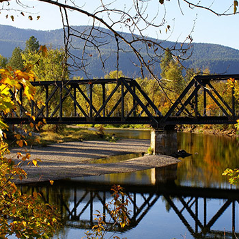
The City’s principle interest was to start the process of integrating natural assets into its overall asset management plan. Water-related issues were already topical in Grand Forks as the City aquifer had been damaged due to gas contamination. Accordingly, the City chose to focus on an oxbow wetland in the center of the urban area. The wetland represents a substantial series of assets in the center of Grand Forks, one that links to the interconnected issues of stormwater, aquifer health, localised flooding and the quality of fish-bearing streams.
Management questions that the City wanted to address through the pilot project included:
- What is the value of the services (quantity, flood control, drought control) provided from the wetland; if these services were degraded, what costs would need to be incurred elsewhere by the City?
- What is the value of the wetland’s water retention properties? Does it offset future capital expenditures and / or justify any land acquisition?
- What is the value of the oxbow wetland in terms of assuring downstream water quality for both fish-bearing rivers and wetland / touristic areas bordering the Kettle River?

Region of Peel, Ontario
The Regional Municipality of Peel (population approximately 1,000,000) is located in Southern Ontario, Canada. The pilot area is the Credit River Watershed (CRW) located for the most part within the Region of Peel. The CRW is approximately 1000 km2 in size with 22 sub-watersheds. Given the large watershed size and correspondingly high data requirements, the pilot focussed on an urban and rural sub-watershed. The Region of Peel – together with partner organization Credit Valley Conservation Authority (CVCA) – had as its principle interest the integration of natural assets into asset management frameworks. As with the City of Grand Forks, water issues were already topical as costs associated with storm events and infrastructure increased due to the impacts of climate change, growth and development.
Management questions that the Region and CVCA explored included:
- What is the value of the services in financial terms provided by the natural assets in the sub-watersheds with respect to avoidance of flooding/erosion, maintenance of clean water (quality) and maintenance of base-flow (quantity)?
- What are the management options with a view to maximization of these services?
- How will observed climate change trends impact the natural assets and the services they provide?
- What are the operations and maintenance costs associated with the management options associated with the natural assets for each scenario?
Click here to view Peel’s case study.
UPDATE: The Region of Peel has since gone on to inventory and assess stormwater services across the entire region. Find out more here!
Town of Oakville, Ontario
Intensification of land use in Oakville, primarily in the form of larger homes than traditional norms, is putting increased pressure on the existing storm water system. As new, larger homes are built, there may be a corresponding and tangible loss of storm water service to the municipality through reductions in permeable surface to absorb and manage the water.
The pilot area is fully urbanized, and so the natural assets that form the basis of the pilot include: publicly-owned ditches, green spaces, tree canopy and the remnants of once-intact streams; and, privately held natural assets such as streams and ditches on the property of individual landowners.
Management questions that Town of Oakville explored through the MNAI initiative included:
- What is the value to the Town of the loss of municipal services created by the conversion of existing natural assets, and is there any corresponding financial risk and/or liability to Oakville?
- What can be learned from the remnant stream in the pilot area that would help Oakville better prioritize and manage other streams in the community?
- Can the monetization of municipal services create a basis for new municipal strategies to manage natural assets?
Click here to read Oakville’s case study.
UPDATE: The results of the pilot have found that Oakville’s natural assets are unexpectedly valuable. Find out more here.
Cohort 2 Project Communities
Over the past two years, MNAI partnered with a group of 6 communities in 3 provinces to explore how healthy natural assets – such as wetlands, forests, ponds – could help address issues such as increased and severe flooding, the impact of urban development, tourism and its impact on drinking water quantity and quality, sediment, erosion, etc. Understanding what services natural assets provide, the economic value of those services, and how climate change affects them allows local governments to better plan for the future.
These Cohort 2 projects further refined the municipal natural asset methodology that was piloted in Cohort 1, and added additional practical examples to the evidence base for municipal natural asset management.
The results show that, overall, the methodology piloted with Cohort 1 has proved robust, the Cohort 2 findings have been consistent with the overall findings from Cohort 1, and evidence and experience from 6 new projects are now available to inform additional actions.
These reports contain the data of the issues, the methodology, the test scenarios, the economic values of the natural assets, the results, and recommendations for solutions.
City of Courtenay, British Columbia
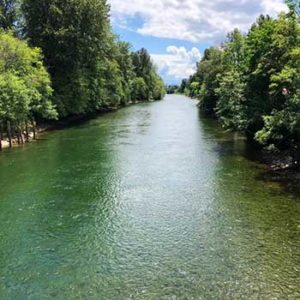
The City has been experiencing increasingly frequent and intense flooding that impacts transportation corridors, businesses, and public and private properties. This project explored the current and possible future roles of natural assets in the Courtenay River corridor in mitigating flood risks in the downtown core, including associated costs and benefits relative to engineered alternatives.
One key finding was that natural asset improvements alone would not solve the flooding problems but would reduce flood damage by between $723,000 and $2.4 million, and relocating at-risk buildings would cost approximately $6.8 million.
District of Sparwood, British Columbia
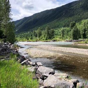
Large stormwater flows have been regularly dumping sediment and other urban runoff into the Elk River, which could increase with more frequent and intense rainfall events from climate change. This would impact the region’s recreation, tourism and fisheries. Sparwood’s Official Community Plan places a strong emphasis on protecting, enhancing and using natural assets so this project explored how to improve water quality in the Elk River through management of the natural assets.
Key findings indicate that enhancing a natural pond that’s at the outlet of a culvert would help it capture 94% of sediment, whereas and the equivalent service from an engineered alternative would cost $248,000 in capital and maintenance costs over the same 25 years.
City of Oshawa, Ontario
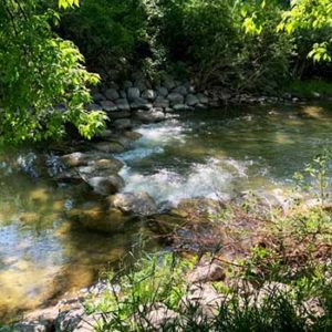
The Oshawa Creek south of Oshawa’s downtown core is experiencing erosion from more frequent storm events. This project explored how to increase the quality and resilience of the riparian area and stream banks along the Oshawa Creek.
Project findings show that natural assets along this segment of the Creek currently provide a stormwater management value of $18.9 million. When including the full Oshawa Creek watershed including the surrounding floodplain, this increases to between $392 million and $414 million. Replacing the natural assets with an engineered asset would reduce the ability to retain water, leading to the potential for more flooding.
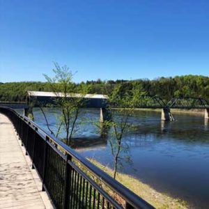
Town of Florencevillle-Bristol, New Brunswick
Increasingly frequent and intense rainstorms along the St. John River in the Florenceville-Bristol region of New Brunswick have caused major flooding, ongoing damage to culverts, expensive repairs, road washouts, and access issues for residents and emergency services. This project explored the role natural assets play in controlling erosion, the associated implications for the maintenance of culverts and roadside ditches, and how much it would cost to replace the forests with engineered stormwater management ponds.
Findings indicate it would cost $3.5 million to re-create the stormwater management services currently provided by the forests with an engineered alternative and, in a changing climate, this value would increase to $4.1 million.
Town of Riverview, New Brunswick
The Town explored how to protect and enhance natural assets in a large development area proposed for the Mill Creek Watershed, adjacent to a nature park. The project estimated the value of stormwater management services provided by existing wetlands based on the cost of replacing the same level of service with stormwater management ponds or built wetlands.
Project findings using different scenarios and climate conditions show the wetlands provide a stormwater service value of $1.07 million to $2.89 million.

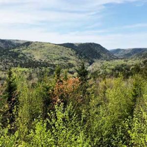
Village of Riverside-Albert, New Brunswick
Water quality and boil water advisories have been a concern for the Village and climate change could affect both water quality and quantity, particularly during dry summer periods when growing tourism adds to demand. This project assessed the Village’s watershed and what actions could be taken to maintain and improve the natural area’s long-term water supply.
Project findings show that replacing the watershed by building a groundwater system would cost between $0.8 and $1.2 million. Buying water and trucking it to the Village would cost $0.8 to $1.1 annually, which can be converted to a present value of $27 to $37 million.
Meanwhile, on Vancouver Island…
Canada’s first watershed-scale municipal natural asset management initiative is now underway!
Several communities in the Comox Valley and the K’ómoks First Nation launched a $367,500 multi-year initiative with the Municipal Natural Assets Initiative (MNAI) this week to help better understand, measure and manage critical drinking water services provided by nature.
The press release is here and the project document is here.
Looking ahead, there is an opportunity for a similar watershed project in Ontario’s Greenbelt; the Request for Expressions of Interest is here.
Register for the MNAI Mailing List
Receive regular updates on our activities, progress, and developments
